CASMA PROVINCE
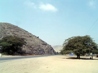
ARRIVING TO CASMA
The city of Casma is the capital of the province of the same name, located at kilometre 375 of the Pan-American Highway. The province extends from the western slopes of the Cordillera Negra, to the coastal zone of the Sub-Pacific Region.
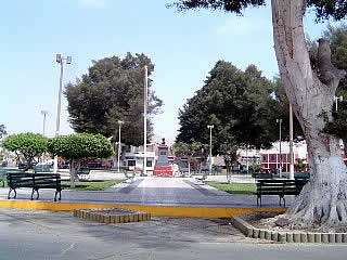
CASMA MAIN SQUARE
The river Casma, is the main watercourse crossing the northern part of the province, whose main tributaries are the Sechin and Rio Grande rivers.
Casma has warm temperature all year-round, hence it is known as the "City of Eternal Sunshine".
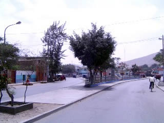
CASMA CITY
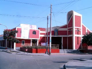
CASMA CHURCH
Casma has countless tourist attractions, ranging from historical to the natural or ecological. The most famous are:
? "Max Uhle", Casma Regional Museum
? Archeological site, Sechin Alto
? Temple/Palace, Sechin
? Pampa Colorada
? Archeological site, Mojeque or Moxeque
? Pampa de Llamas
? Chanquillo
? Archeological site, Las Aldas
? Waro: Former Fishermen's Village
? Beach La Gramita
? Tortugas Spa
Other attractions not so well known are:
? Taukachi - Konkan
? Petroglyphs Jaihua
? Pampa El Rosario
? Huaca Desvio
? Guala?o
? Huerequeque
? San Diego
? Pallka
In "The Ancash Highlands" we will refer to all of them, but will present only those having some tourist material.
RED PAMPAS (PAMPA COLORADA)
LOCATION
In the southwest flank of the Lomo de Camello hill, and to the left of the road Casma-Yaut?n-Huar?z; district of Buenavista. From the city of Casma there are 16 kms. to the archaeological site.
DESCRIPTION
In alluvial stony soil, declining southward, surrounded by hills on the west, north and east sides, large designs have been made on the floor with faint depth trenches; width averaging 20 cm.
From the top of the opposite hill one can see a frontal standing human figure, which seems to have in his right hand a stick or spear; nearby is a feline profile, apparently a puma, two other animals that can be camelids, a sigmoid figure representing a thunderbolt, a likely bird head and unidentified geometric motifs.
Moreover from the site, straight lines some miles long are projected toward the Sechin valley.
The first site found with lines or rather, trenches on the ground, was the Pampas de Nazca, but then others were discovered in different valleys, such as Pampa Colorada.
Clearly, the site was chosen to make the drawings because it was distant from the valley and located between isolated hills. They represent elements of wildlife, activities and beliefs of the time, therefore, it had magical-religious functions and perhaps even relationship with astronomical studies related to farming of the time.
The human character of Pampa Colorada, recalls the muddy bas relief motive found by Rosa Fung in the wall of one of the passages of Chanquillo and equally, the "chaman" identified in one of the petroglyphs of Palamenco, Valley Lacramarca (District of Chimbote).
Keeping distances, the characteristics and differences among the three sites, a close relationship between the three characters is found, in terms of representation and style, so perhaps the chronological location of Pampa Colorada is the Superior Formative Period.
WARO: FORMER VILLAGE FISHERMEN
LOCATION
It is fourteen kilometers north of Aldas, on a tip of land of 5 hectares and surrounded by the sea. The site can be reached on foot or by car; there is a path from the North Pan-American Highway at Km 346.5.
DESCRIPTION
At the center of the site there are some 300 collapsed houses, having adapted themselves to the sloping topography of the ground, built only with pebbles, they are circular or square, 2 m. aside and 1.50 m. tall. They were arranged in the opposite direction to the wind to avoid the cold at night.
Towards the North and Southeast sides there are larger buildings on terraces, closely communicated amongst them, denoting communal use or other important purposes. Also, their construction stones are larger and show to have been chosen, while the perimeter walls are wide and with the stones stacked on slope.
All these buildings have an ocean view, contrary to those for housing, noticing the existence of one to two workshops.
Towards the eastern side there are other terraces now covered with garbage, and whose volume allows deducing that it had been occupied for a long time. In many sectors are remnants of marine plants, pottery and other. The abundance of fish bones, shells and bones of birds, suggests the intense exploitation of local resources. The presence of plant debris: squash, corn, cotton, soursop, rattan, cattails and other, tell about the permanent interexchange of marine products with farmers in the basin of Casma or neighbouring valleys. Also, on the surface there are fragments of early pottery, neckless pots and more recent ones, as well as stone artifacts such as crushers, scrapers, "bat?n" hand, etc.
Its strategic location, the beauty of the natural surroundings and the age of its cultural remnants, more than 3000 years, make of WARO, a place one must visit. Finally WARO was not the only village, there are others, who were linked to Las Aldas.
GRAMITA BEACH
Located south of Casma, At Km. 345, of the Pan-American North Highway an affirmed path enters and runs only two kilometers to get there. It is a vast sandy beach, with good waves and many marine resources.
The many beaches encountered allow visitors to have the best choice to enjoy tranquility and privacy, as well as fishing, diving, boat ride and shellfish collecting shellfish or seafood.
Nearby is the fisherman's cove "Gramita", were one can buy fresh fish in the morning or evening, when they return from their fishing. Also, there is the Tourist Camp "Las Aldas" which provides services throughout the year.
In addition to the sea, beaches, food services and lodging, 800 meters southward is the archaeological site "Las Aldas," where one can walk without problems.
Source: Archaeological Series N? 12
Page translated by courtesy of: Carlos Dextre.
Página web creada el 30 de marzo del 2005.
© Copyright 2005 Gualberto Valderrama C.
|

 SPANISH
